|
Maps |
||
|
|
|
|
|
Modern map OS OpenData. Version date June 2026 (The Portishead to Pill section of line should really be shown dotted) Click map to enlarge |
The map above is courtesy of the MetroWest project showing Phases 1 and 2 of the local network. Click map to enlarge
|
West of England Mayoral Combined Authority map showing future stations to open by 2027/28 in red, including the Portishead and Henbury lines, and aspirational ones in purple. Click map to enlarge |
|
|
|
|
|
The map above is courtesy of Bristol Rail Campaign showing their proposed local network. Click map to enlarge |
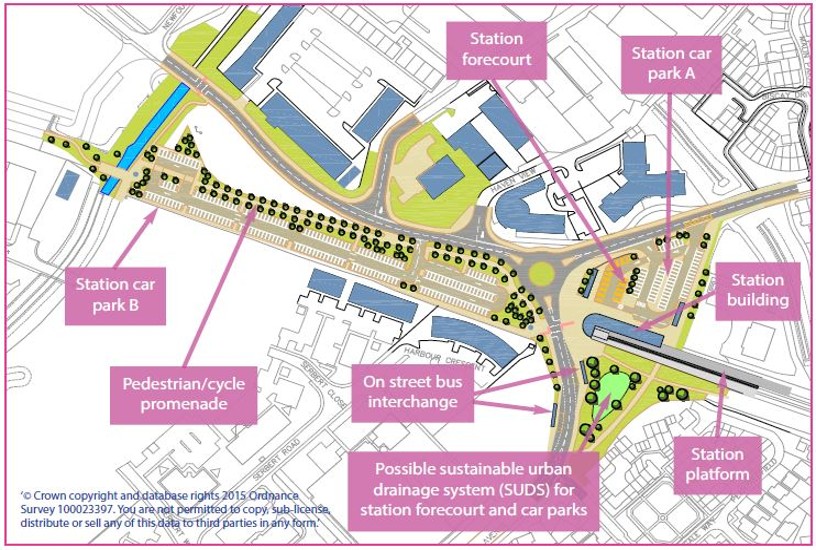
The map above shows the site of the new Portishead station. The roundabout has been moved about 75m to the left(west) of its current location. Note that there could be detailed changes to this layout. Click map to enlarge |
The map above is a basic representation of the road layout changes coming in Portishead. Click map to enlarge |
|
|
|
|
|
The map above shows the location of the future new station at Portishead with rejected options and the route of the line to be reopened. Click map to view |
The map above shows the Portishead line as it will be when reopened. Click map to enlarge |
The map above shows the work planned at Pill station and surrounding area. Click map to enlarge |
|
Planning Applications (approved) Portishead station Pill Station |
|
|
|
|
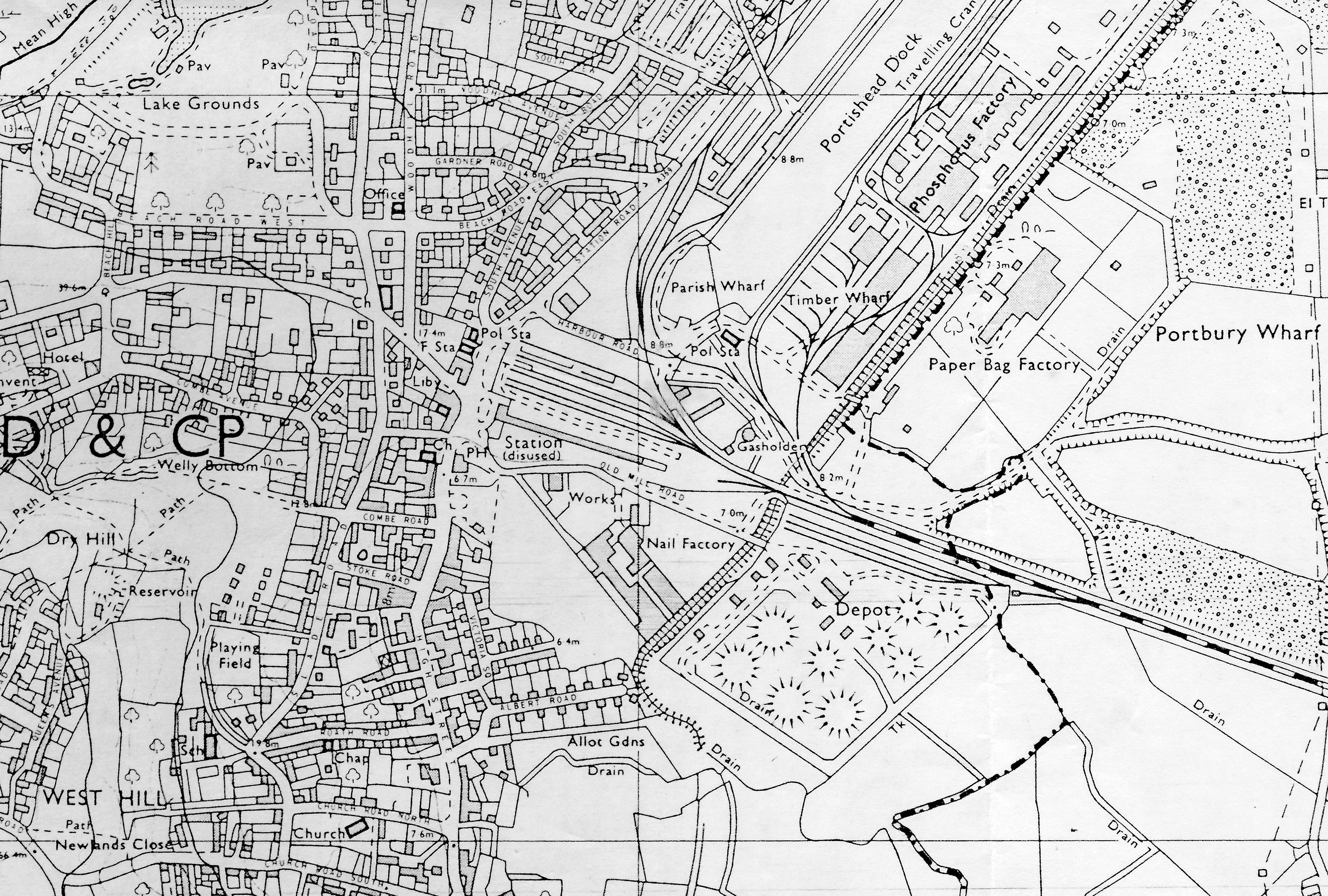
Old Portishead station in late 1960s after passenger line closed. Click map to enlarge |
The map above shows the local rail network in 1955 (From Railway Magazine). Click map to enlarge |


Copyright © 2005-2026 Portishead Railway Group